What you need to know about rips and tides on Phillip Island.Precisely, it’s not just a good story to tell when you’re on the beach; the knowledge of how rips and tides work can actually keep you safe. Anyone who’s stood on Bass Strait and watched swell pouring in from the Southern Ocean will know that the water around Phillip Island is a force to be reckoned with – it’s a bit like The Rip at Port Phillip Heads, a wild and unpredictable place thats always worth taking seriously – and that’s precisely why knowing your rips before you dip your toes in the water is a good idea.
Contents
- 1 Why Rips Form — And Why Travellers Miss Them
- 2 Beaches Where Rips Are Most Likely To Fire Up
- 3 Tide Behaviour Every Traveller Should Know
- 4 Safety Snapshot
- 5 How To Spot A Rip Before It Spots You
- 6 What To Do If You Get Caught In A Rip
- 7 Rock Shelves, Reef Breaks, And Other Sneaky Hazards
- 8 Safety Checklist Before You Swim
- 9 FAQ
Why Rips Form — And Why Travellers Miss Them
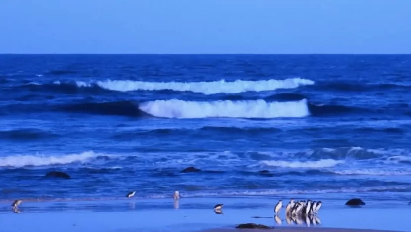
Rips don’t always look like the danger zone. On Phillip Island, around Cape Woolamai, Surfies Point and Smiths Beach, the worst bits are often the patch of water that looks dead flat – that’s where the Rip Currents are hiding – those sneaky channels that carry water out to sea with a speed you wouldn’t believe. On one of our Wildlife Tours beach stops, I remember a guest asking why the calmest water always seemed like the safest option – that’s a mistake that a lot of Penguin Island tours Melbourne by Wildlife Tours travellers make when they first hit Bass – and it’s a classic error.
To put it simply, a rip is just the water going back out after all the water from the waves that start piling up near the beach spills back out to sea. It’s the same principle as the tide going in and out of The Heads between Point Lonsdale and Point Nepean. Throw in tidal currents, changes in wave height, ground swell, shifting sand bars, and it’spowerful and it’s a real moving puzzle.
Common rip indicators on Phillip Island beaches:
- Darker-looking channels created by Deep rips or a brand new Rip Bank.
- Water that’s nice and smooth right next to waves that are breaking – it’s a rip’s signature move.
- Sand and foam are getting swept out to sea.
- Wave patterns that seem a bit off, possibly because of changes in swell period or the sheer size of the high swell.
I recall an old mate from Woolamai telling me once that “if it looks easy to swim, it’s probably a rip” – I reckon he was right on the money after watching a few unsuspecting tourists drifting off to Bass Strait like an untethered tinny – so be careful!
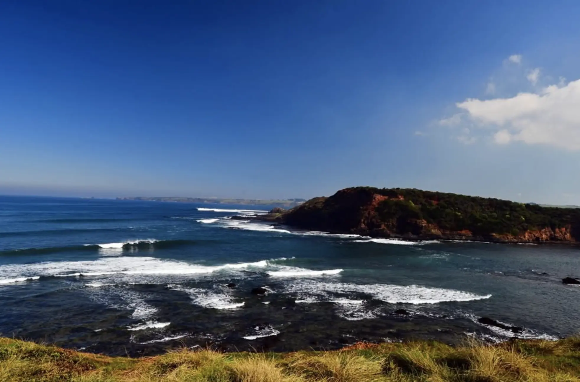
Beaches Where Rips Are Most Likely To Fire Up
Some bits around this island are perfect for a paddle around, others will have you scrambling to get out of the water as fast as possible. And when that Pt Nepean Swell Buoy shows the swell’s really started to kick in, places like Cape Woolamai and Cat Bay can turn nasty in no time.
High-Energy Surf Spots (Watch Closely)
- Woolamai Surf Beach – this place has some powerful rips, the sand bars are constantly shifting, and the surf’s pretty heavy.
- Surfies Point – loads of boardriders love it here, thanks to the island’s rich surfing history, but the rips are always working.
- Cat Bay – it’s a cracking reef break when the swell is right, but on the wrong day it can suck you out really fast.
- Berrys Beach – looks pretty relaxed, but if the swell’s big, it can act like a pipe for water to shoot out to sea.
- Forrest Caves – the wave action has created some pretty cool formations over time, but watch out for the strong water moving out – it can be a real hazard.
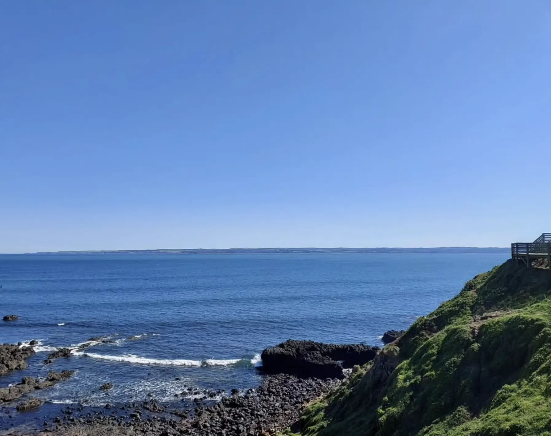
More Sheltered Swimming Spots (Still Read Conditions)
- Cowes Beach – the sea here’s usually pretty calm thanks to the Port absorbing a lot of the swell.
- Ventnor Beach – it’s nice and quiet, but still beware of those tidal streams – they can pull you sideways in no time.
- Red Rocks Beach – great for a walk, rips are very rare but can still happen.
- Summerland Beach – that place is a right old favourite for penguin spotting – don’t go swimming there or you might get wet in more ways than one – it’s best to stick to the land.
Tide Behaviour Every Traveller Should Know
Western Port and Bass Strait don’t mess around. If you’ve ever watched the water going slack at “The Rip” suddenly speed up – you know just how quickly things can change, and Phillip Island‘s got some pretty similar speed bumps to cope with.
Some key things to bear in mind re tide:
- Ebb tide can make rips a lot worse around Cape Woolamai and Kitty Miller Bay.
- Flood tide can push water right over the shallow bars you can walk on, creating all sorts of strange channels.
- Tidal streams can be moving in no time at all at places like Pound Creek and Shortlands Bluff.
- Swell forecast – especially if you check the latest from Swellnet or Wave Size Swellnet Forecast – changes everything as to where and when the rips will show up.
One minute you’re ankle deep near the rock pool, the next you’re wading through water up to your neck after the tide comes in – it’s totally unpredictable.
Safety Snapshot
| Beach | Rip Risk | Tide Impact | Lifeguards Present (Summer) | Notes |
|---|---|---|---|---|
| Woolamai Surf Beach | Very High | Strong | Yes | Influenced by Bass Strait swell, Deep rips are common |
| Surfies Point | High | Strong | No | Reef break + strong lateral flow |
| Smiths Beach | Moderate–High | Moderate | Yes | Popular for surf schools; watch tidal indicators |
| Cat Bay | Moderate | Moderate–Strong | No | Reef energy changes the wave quality quickly |
| Forrest Caves | High | Strong | No | Wave erosion + caves create a surge |
| Cowes Beach | Low | Mild | No | Sheltered by Western Port |
| Ventnor Beach | Low–Moderate | Moderate | No | An outgoing tide can pull |
Stat: Surf Life Saving Australia reports that most drowning deaths occur on unpatrolled beaches, especially where rips interact with shifting swell and tide conditions.
How To Spot A Rip Before It Spots You
Understanding rips is partly about ocean smarts, partly good old-fashioned common sense, and partly about paying attention to the local tools that can help you stay out of trouble – think tidal indicator buoys, navigation aids, or even that Surf Life Saving Australia Beachsafe App you’d do well to download.
Visual Cues
- Smooth gaps between breaking waves
- Outflow channels shaped bythe tide
- Discoloured or sediment-filled water
Behaviour Cues
- Sudden sideways pull
- Rapid deepening underfoot
- Water “running like a river” beneath the surface
Just like when you’re out on the water with Navigation aids or a C-MAP electronic chart to help guide the way, reading rips is all about reading the flow and the shape.
What To Do If You Get Caught In A Rip
Rips don’t pull you down – they pull you out to sea. And panic usually does the rest of the damage.
- Stay Calm And Float
Conserve your energy and your oxygen – panic will get you nowhere fast. - Let The Rip Take You Until It Weakens
Most rips will run out of steam once you get into deeper water, so just go with it. - Swim Parallel To Shore
Don’t try to swim inland – that’s just asking for trouble.
If you can’t get out of the rip, just signal for help. These days, a lot of beaches are equipped with safety devices like Angel Rings or even Delayed Surface Marker Buoys – just knowing they’re there can be a real blessing.
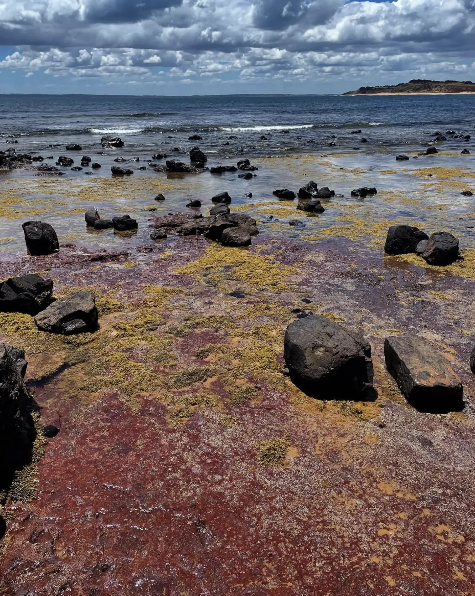
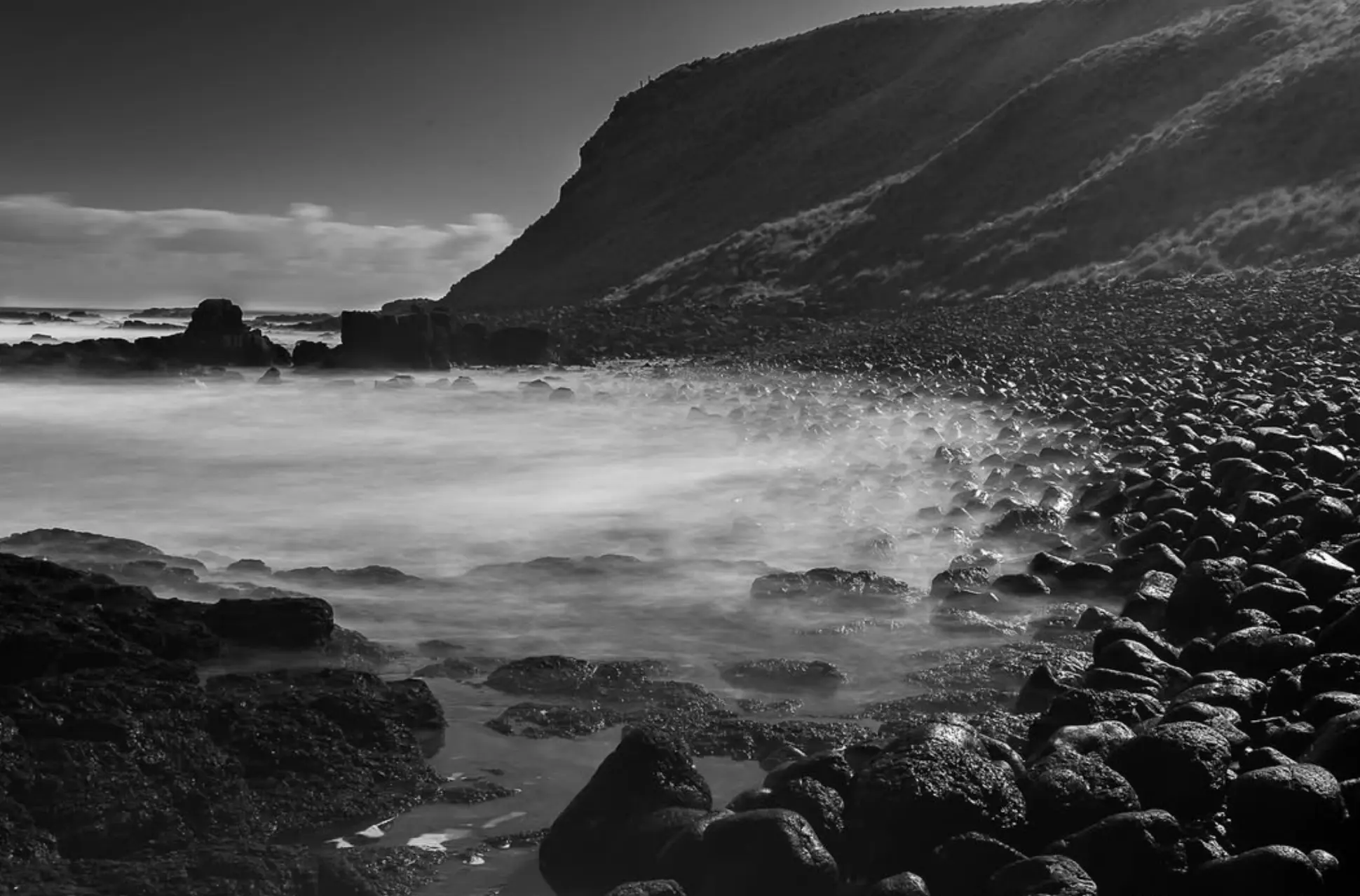
Rock Shelves, Reef Breaks, And Other Sneaky Hazards
Some of the most beautiful spots – like Forrest Caves, Cape Woolamai’s rock shelf and Summerland’s rugged coastline – are also some of the most treacherous. It’s no wonder wave erosion continues to shape this coast.
- Rising water levels around rock shelves
- Sudden surges of water into sea caves
- Slippery volcanic rock formations – that’s just an accident waiting to happen
- Instability around eroding cliffs – that’s a warning sign
No wonder Phillip Island is part of one of Victoria’s UNESCO biosphere reserves – nature is raw and powerful and still going strong.
Safety Checklist Before You Swim
- Check BeachSafe and local wave forecast tools
- Understand wind direction — W–NW wind can whip the coast into chaos
- Choose patrolled beaches when possible
- Avoid reef breaks if you’re not experienced
- Know tide times and slack water windows
- Respect conservation areas protecting species like the Hooded Plover
FAQ
Do rips on Phillip Island behave like The Rip at Port Phillip Heads?
Not exactly – but in principle, yes. Fast-moving water shaped by swell, tide and depth – that’s what you need to watch out for.
Does tide influence rip strength?
You bet it does. Ebb tide often makes the currents run faster, and flood tide reshapes the sandbars and creates new channels.
Which beach is best for beginners?
Smiths Beach is a great spot – especially with surf schools like Island Surfboards on hand to guide you through the basics. They read the wave quality and the tides for you – so you don’t have to.
How do I check real-time swell?
You can use Swellnet, the Pt Nepean Swell Buoy or even Safe Transport Victoria sea-state updates.
What wildlife should I be aware of?
You’ve got sea creatures like seals, rays, gummy sharks, and even the occasional Southern Right Whale cruising past Bass Strait during winter.